Kormakitis (Kormakítis)
Kormakitis (Cypriot Arabic: Kurmajit; Κορμακίτης, Kormakítis; Kormacit or Koruçam) is a small village in Cyprus. It is under the de facto control of Northern Cyprus. Kormakitis is one of four traditionally Maronite villages in Cyprus, the other three being Asomatos, Agia Marina and Karpaseia. The Maronites of Kormakitis traditionally speak their own variety of Arabic called Cypriot Maronite Arabic (CMA) in addition to Greek and recently Turkish. Cape Kormakitis is named after the village.
All of the remaining Maronites villagers are elderly. The Republic of Cyprus government gives those who stayed in the north pensions of $670 a month per couple and around $430 for an individual. It also pays instructors to teach CMA, and funds week-long summer visits by young Maronites to put them in touch with their communal roots. Maronites also receive help from the United Nations. Every two weeks UN troops make the trip from Nicosia to deliver food, water, fuel and medical supplies across the border to the north’s Maronite population. The UN aid convoy is manned by soldiers from the 12 Regiment Royal Artillery. Aid is funded by the Republic of Cyprus government but is delivered by the UN.
During the weekends the population of Kormakitis increases to more than 600 as displaced former residents return to visit relatives and celebrate Mass. Access has been made easier since 2003 when the Turkish Cypriot authorities relaxed rules on visits to Northern Cyprus. Many Maronites who were displaced from Kormakitis have renovated and upgraded the village and homes for weekend use.
There are several versions for the name of the village. The most common instance of folk etymology is related to the Maronites who arrived from Kour, Batroun. Feeling nostalgic, they used to repeat the sentence "Nahni jina wa Kour ma jit" "We came here (to Cyprus) but Kour hasn't (came)". Another instance of folk etymology is related to the Phoenician settlement of Kormia. The present village would take its name from the expression Kormia jdide, or "New Kormia". These hypotheses seem consistent with the pronunciation of the village in Cypriot Greek (Κορματζίτης /Korma'dʒitis/) and Cypriot Turkish (Kormacit /Korma'dʒit/). The standard Greek name Kormakitis is an attempt to adjust the name to standard Greek pronunciation, whereas the new Turkish name Koruçam was made up after 1974 for political reasons.
Map - Kormakitis (Kormakítis)
Map
Country - Cyprus
 |
 |
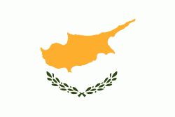
| Flag of Cyprus | |
The earliest known human activity on the island dates to around the 10th millennium BC. Archaeological remains include the well-preserved ruins from the Hellenistic period such as Salamis and Kourion, and Cyprus is home to some of the oldest water wells in the world. Cyprus was settled by Mycenaean Greeks in two waves in the 2nd millennium BC. As a strategic location in the Eastern Mediterranean, it was subsequently occupied by several major powers, including the empires of the Assyrians, Egyptians and Persians, from whom the island was seized in 333 BC by Alexander the Great. Subsequent rule by Ptolemaic Egypt, the Classical and Eastern Roman Empire, Arab caliphates for a short period, the French Lusignan dynasty and the Venetians was followed by over three centuries of Ottoman rule between 1571 and 1878 (de jure until 1914).
Currency / Language
| ISO | Currency | Symbol | Significant figures |
|---|---|---|---|
| EUR | Euro | € | 2 |
| ISO | Language |
|---|---|
| EN | English language |
| EL | Greek language |
| TR | Turkish language |


